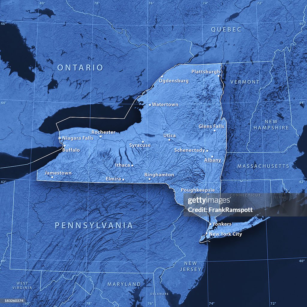
New York città mappa topografica - Foto stock
"3D render and image composing: Topographic Map of the State of New York, USA. Including state borders, cities, rivers and accurate longitude/latitude lines. Very high resolution available! High quality relief structure!Relief texture and satellite images courtesy of NASA. Further data source courtesy of CIA World Data Bank II database.Note: This image is perfectly congruent to the image"

Ottieni questa immagine scegliendo tra varie cornici su Photos.com.
ACQUISTA UNA LICENZA
Tutte le licenze royalty-free comprendono diritti di utilizzo globali, protezione completa e prezzi semplici con sconti sul volume di acquisto
385,00 €
EUR
Getty ImagesNew York Citt Mappa Topografica, Foto stock Scarica da Getty Images autentiche foto stock premium di New York città mappa topografica. Esplora foto stock simili ad alta risoluzione nel nostro vasto catalogo.Product #:183260374
 Scarica da Getty Images autentiche foto stock premium di New York città mappa topografica. Esplora foto stock simili ad alta risoluzione nel nostro vasto catalogo.Product #:183260374
385€50€
Getty Images
In stockDETTAGLI
Attestazione:
N. Creative:
183260374
Tipo di licenza:
Collezione:
E+
Max. dimensione file:
2810 x 2810 px (23,79 x 23,79 cm) - 300 dpi - 5 MB
Data di upload:
Info sulla liberatoria:
Liberatoria non necessaria
Categorie:
- Carta geografica,
- New York - Stato,
- New York - Città,
- Stati Uniti d'America,
- Rochester - New York,
- Albany - Stato di New York,
- Tridimensionale,
- Carta topografica,
- Laghi Finger,
- Buffalo - New York - Stato,
- Long Island,
- Syracuse - New York,
- Yonkers,
- America del Nord,
- Blu,
- Geologia,
- Latitudine,
- Longitudine,
- Monti Adirondack,
- Parco Statale degli Adirondack,
- Topografia,
- Vista satellitare,
- Affari,
- Appalachia,
- Cartografia,
- Composizione digitale,
- Forma,
- Geografia fisica,
- Illustrazione,
- Immagine a colori,
- Immagine generata al computer,
- Lago Ontario,
- Monti Appalachi,
- Oceano Atlantico,
- Quadrato - Composizione,
- Senza persone,
- Utica - New York,
- Viraggio monocromo,
- Vista della costa,