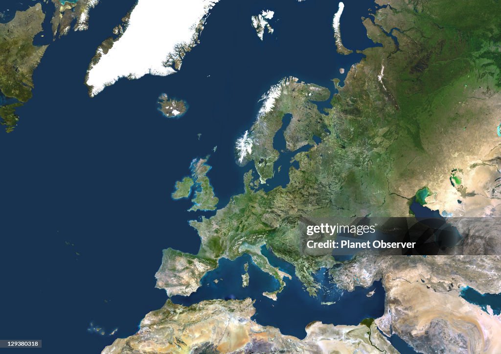
Continental Europe, True Colour Satellite Image
Europe. True colour satellite image centred on Europe. North converges towards top. The terrain of Europe varies from arid, dusty areas (brown) to fields, forests and plains (green). Mountain ranges include (left to right): the Pyrenees, the Alps, and the Carpathians. Snow and ice is seen on mountains in Scandinavia and Iceland (upper left). Seas are the Mediterranean Sea (lower centre), the Blakek Sea, Caspian Sea and Red Sea (lower right), the Baltic Sea and North Sea (upper centre) and the Atlantic Ocean (left). Also seen are Greenland (top left), Russia and the Middle East (right), and North Africa (bottom).The image used data from LANDSAT 5 & 7 satellites., Continental Europe, True Colour Satellite Image (Photo by Planet Observer/Universal Images Group via Getty Images)

ACQUISTA UNA LICENZA
Come posso utilizzare questa immagine?
385,00 €
EUR
Getty ImagesContinental Europe, True Colour Satellite Image, Foto di attualità Continental Europe, True Colour Satellite Image Scarica foto di attualità Premium ad elevata risoluzione da Getty ImagesProduct #:129380318
 Continental Europe, True Colour Satellite Image Scarica foto di attualità Premium ad elevata risoluzione da Getty ImagesProduct #:129380318
475€175€
Getty Images
In stockNota: le immagini che ritraggono eventi storici potrebbero contenere soggetti, o avere descrizioni, che non riflettono le concezioni attuali. Vengono presentate in un contesto storico. Per saperne di più.
DETTAGLI
Restrizioni:
Contatta l'ufficio locale per informazioni su qualsiasi tipo di uso commerciale o promozionale.
Attestazione:
N. Editorial:
129380318
Collezione:
Universal Images Group
Data di creazione:
1 gennaio 2002
Data di upload:
Tipo di licenza:
Info sulla liberatoria:
Senza liberatoria. Ulteriori informazioni
Fonte:
Universal Images Group Editorial
Nome oggetto:
913_03_PO00011
Max. dimensione file:
4961 x 3508 px (42,00 x 29,70 cm) - 300 dpi - 8 MB